Geospatial Science
The Geospatial Science major operates at the crossroads of leading-edge technology and geographical expertise. Geoscience majors will learn to identify challenges related to contemporary global issues such as climate change, geopolitics, cultural patterns, and economic and political insecurity. Using advanced tools and equipment such as drones, satellite imagery, maps, lasers, and advanced spatial analysis, the Geospatial Science major will be able to analyze and interpret complex data in order to make informed decisions that will shape our world.
A Foreign Language minor enhances a degree in geospatial science, and can be accomplished without carrying an academic course overload. Cadets who excel in this program have opportunities for advanced studies such as the Rhodes, Fulbright, Marshall, and Academy Graduate Scholarship programs.
-
Why study Geospatial Science at the U.S. Air Force Academy?
Are you passionate about understanding the relationships between people and places? Are you interested in using advanced technology to obtain and interpret complex information? Do you want to work with experienced faculty members who are passionate about their field? Then Geospatial Science is the right major for you.
Geospatial Science fulfills an important Academy institutional outcome of integrating knowledge about human cultures and the natural world. A geoscientist at the United States Air Force Academy will use state-of-the-art technology to capture, analyze, and display data to study the human, cultural, and physical patterns on the earth’s surface. They will utilize and master advanced tools and techniques including Geographic Information Systems (GIS), geovisualization, Global Navigation Satellite Systems (GNSS), Global Positioning (GPS), spatial data analytics, and geospatial modeling.
Facilities and devices include:
- Two state-of-the-art laboratories each with 24 high-performance workstations and dual monitors for GIS and Remote Sensing analysis.
- Two large format plotters for printing posters and maps
- Handheld GPS (GNSS) units for fieldwork.
- A variety of drones, both quadcopters and fixed wing, with different sensors that include Near-Infrared, Forward-Looking Infrared Thermal sensors, and Light Detection and Ranging (LiDAR).
-
How does geoscience prepare me for an Air Force or Space Force career?
This hands-on major will be valuable for almost any career in the Air Force or Space Force, including pilot, intelligence officer, and special tactics officer.
As a civilian, your skills will be invaluable in careers in data science, geospatial intelligence (GEOINT), civil service (including planning), and private industry, among others.
Geospatial Science majors integrate knowledge of human cultures and the natural world and use the power of digital information systems and spatial data analytics to address the world’s pressing and most complex problems such as terrorism, resource scarcity, geopolitical conflict, and climate change. All of are integral to the military’s global mission.
-
What courses are offered?
The discipline encompasses three pillars: Human Geography, Physical Geography, and Geospatial Techniques. Integrative courses require foundational prerequisites.
Human Geography
Physical Geography
Geospatial Techniques
Intro to Human Geography*
World Regional Geography*
Economic Geography
Geography of Culture and Travel
Geography of International Conflict
Intro to Physical Geography*
Geomorphology*
Field Study in Physical Geography
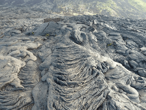
Physical Geography of Volcanic Landscapes
Geographic Information Systems (GIS)*
Intro to Remote Sensing*
Advanced GIS
Advanced Remote Sensing
Cartography*
Photogrammetry
Integrative Courses
Military Geography*
Geospatial Intelligence
Capstone in Geospatial Science**required courses for the major
Most courses are project-based and make use of data-driven computer-based technologies known as geographic information systems (GIS). Students will analyze spatial data and phenomena to explore and explain evolving relationships between human activity and the Earth’s natural environment over space and time.
Potential areas for study and research are nearly limitless, from environmental degradation, climate change and natural resource management, to site suitability for commercial activities. Topics can also include addressing homelessness, predicting political violence and protest.
Many courses are practical in nature rather than theoretical and involve hands-on learning with drones, lasers and other emerging technologies.
Sample Courses
- Human Geography: A Global Cultural Awareness (GEO 250) – Are you fascinated by what makes people and places unique, yet interconnected at the same time? Do you enjoy learning about the complex relationship between humans and their environment? In Human Geography: A Global Cultural Awareness, you will be exposed to major ideas, concepts, institutions, and events that shape human cultures and societies. You will develop an understanding of humans and the places they inhabit through the study of human movement, language, religion, race, economic activities, and urban development. You will become familiar with using satellite imagery and interactive mapping systems to gain a strategic understanding of diversity, and utilize these skills in your Air Force or Space Force career.
- Physical Geography (GEO 351) – Military careers are often synonymous with global travel and adapting to unfamiliar surroundings. Upon taking the Physical Geography course, you will gain a comprehensive scientific understanding of natural environments, from a global perspective down to the local level. As a physical geography student, you will synthesize many concepts from the Academy’s required core classes, and apply them to the physical geography of a location. You will be able to identify the models and processes that lead to that physical geography, and be able to clearly articulate the interaction of that environment with humans and human activity. Hands-on learning is inherent to geoscience so be prepared to be out and about. We will use equipment and technology including infrared thermometers, sling psychrometers, GoogleEarth, mineral identification kits, and GPS receivers.
- Geospatial Intelligence (GEO 488) – Geospatial Intelligence allows all cadets, not just geoscience majors, the chance to learn about intelligence analysis from a spatial perspective. In this course, created and supported in collaboration with career GEOINT analysts and experts, students examine applications of imagery, intelligence, spatial technologies, and analytical practices. Through field trips, guest lectures, and hands-on exercises, students interact with mentors from military organizations, the intelligence community, and industry. Previous guests represented the North American Aerospace Defense Command, U.S. Northern Command, the 566th Intelligence Squadron, 319th Combat Training Squadron, the National Geospatial-Intelligence Agency, the U.S. Forest Service, the Bureau of Land Management, Maxar Technologies, and others.
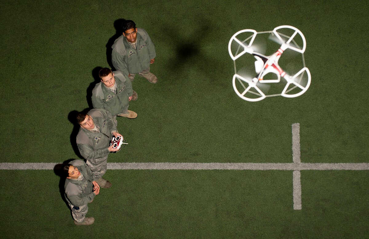
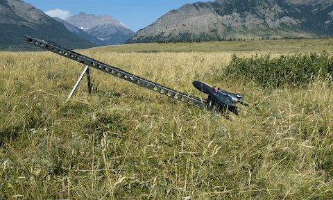
Learn how an extensive counterdrug exercise at the Academy netted a substantial crop of Marijuana stashed in the school’s main field training area. Geo cadets combined satellite and drone imagery with other intelligence to locate and identify the fake grow sites. Check out the full article.
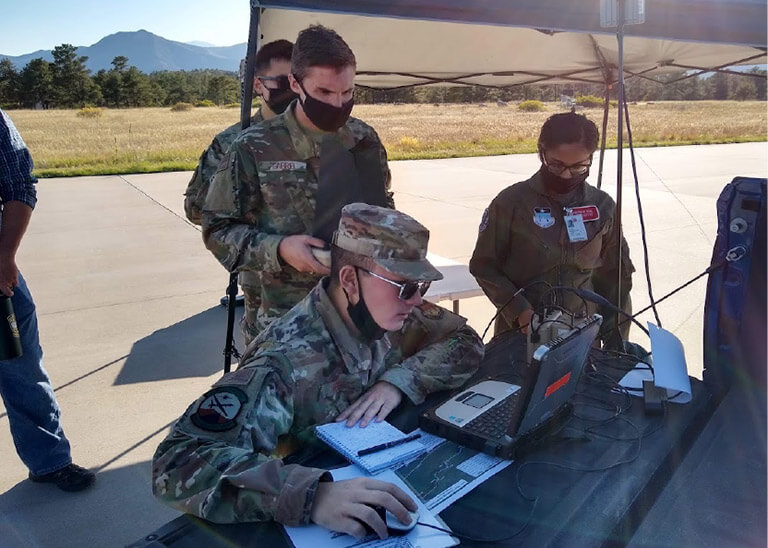
Cadets controlling Remotely Piloted Aircraft in support of a geospatial intelligence counterdrug field exercise.
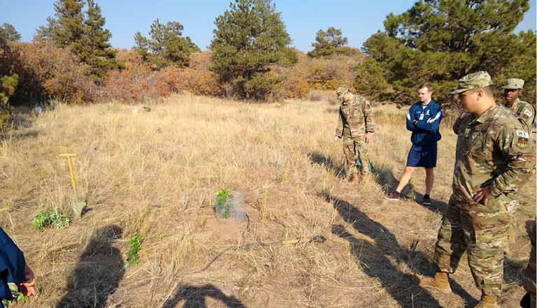
Cadets “ground-truthing” marijuana grow sites (using synthetic plants) in Jack’s Valley as part of a Geospatial Science field exercise.
-
What is the suggested course sequence for the major?
SUGGESTED COURSE SEQUENCE
4th CLASS YEAR (FRESHMAN) 3RD CLASS YEAR (SOPHOMORE) 2ND CLASS YEAR (JUNIOR) 1ST CLASS YEAR (SENIOR) Beh Sci 110
Chem 100
Com Sci 110
English 111
Engr 101
For Lang 1
For Lang 2
History 100
Math 141
Math 142
Physics 110Chem 200
Econ 201
ECE 315
English 211
Mech Engr. 220
Geo 310
Geo 350
History 300
Law 220
MSS 200
Physics 215
Pol Sci 211Advanced Literacy Opt
Aero Engr 315
Astro Engr 310
Beh Sci 310
Biology 315
Electives
Geo 351
Geo 370
Geo 382
Math 300
Philos 310
Soc Sci Div OptAcademy Opt
Advanced Literacy Opt
Elective
Elective
English 411
Geo 490
Geo 498
Mgt 400
MSS 415/416
Soc Sci 412For full program requirements and course descriptions, download the current Course of Instruction Handbook.
-
Are there cadet research and travel opportunities?


Each year, select cadets pursue on-site classified research with intelligence agencies such as the Defense Intelligence Agency and the National Geospatial Intelligence Agency. Most Geospatial Science majors also pursue the Geospatial Intelligence Certificate, an academic and professional credential recognized by the geospatial-intelligence community.
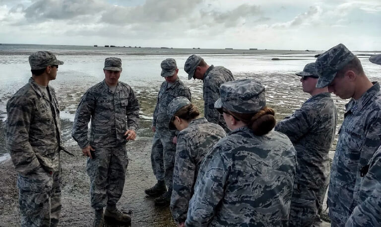
Cadets also have numerous opportunities to participate in off-site field trips and summer travel, further enhancing geographic understanding through exploration. Recent trips include travel to Israel, France, and Antarctica, as well as local experiences to Garden of the Gods and Painted Mines.
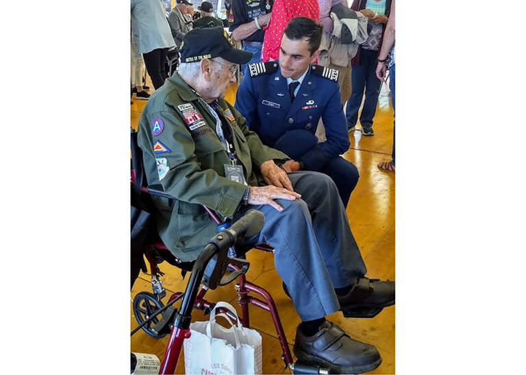
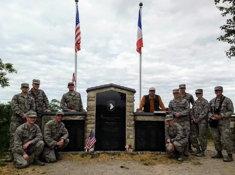
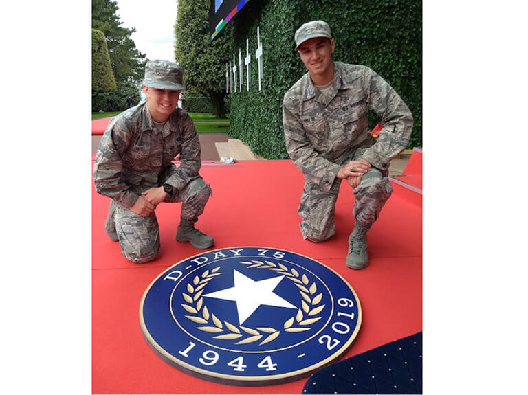
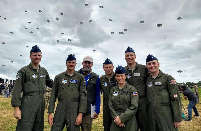
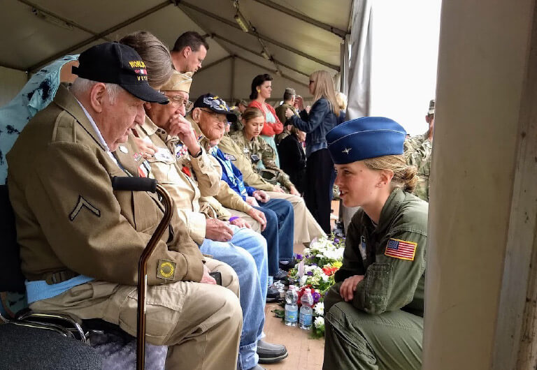
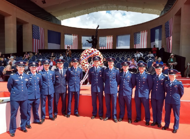
Cadets from the Geospatial Science program took a two-week academic journey to Normandy, France, where the allied campaign, Operation Overlord, occurred. The group participated in the D-Day 75th Anniversary memorial ceremonies honoring World War II veterans and European allies. Read more about this educational trip.
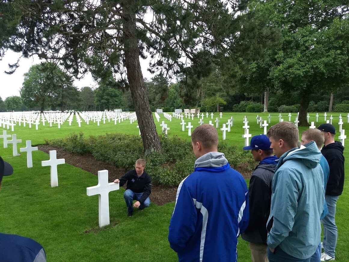
Cadets from the Academy visit the Normandy American Cemetery, containing the graves of more than 9,380 U.S. service members, June 2019. Most of those service members lost their lives in the D-Day landings and the ensuing operations.
-
What do cadets think of the major?
Cadets tell us why they picked the geospatial science major.
“I picked the geo major because the mapping and spatial analysis is integral to what I enjoy doing in my free time like hunting and fishing.” – Cadet Landon Chandler
“I ended up choosing geo because it combined many of my interests into one major, and more importantly it could give me a degree that can be used inside and outside of the Air Force. I love geopolitics, maps, cultural interactions, the environment and history, all of which are covered in one aspect or another within the major.” – Cadet Kyle Ublacker
“I picked the geo major because it teaches skills, such as GIS and Remote Sensing” – Cadet Justin Wilmoth
“I have always loved maps and have had a lot of practice with them backpacking as well as in SERE this past summer. I wanted to gain a better understanding of how maps were created and modern uses. Additionally, I had heard that in geospatial science you could take classes directly related to military intelligence in “the big Air Force,” and that is what drew me into the major.” – Cadet Tatum Boldt
“This major presents opportunities in a multitude of careers and paths of study. Geospatial Science allows you to hold the world in your hand and see its past, the present, and even interpolate its future.” – Cadet Gabrielle LaRochelle
Cadets explain what they like best about this major.
“There are a variety of classes you can take. I’ve taken culture classes to computer-based program classes. You can easily find your niche in geospatial science.” – Cadet David Gray
“I love that every instructor is supportive and available for extra instruction and that the classes teach concepts applicable to everyday life.” – Cadet Justin Wilmoth
“Geo is challenging yet also rewarding […] I would recommend this major to anyone!” – Cadet Grace Everts
“Geo has not only been a perfect match for me, between fuzzy and technical material, but I love what we do and study.” – Cadet Mackenzie Eddy
“With all the different aspects of the major, there are just so many cool things to learn about. Whether you like the physical geography, human geography, military applications, or technical aspects of the major, there is something for everyone and the people in the major are now some of my closest friends.” – Cadet Ryan Clements
-
What are some examples of potential job assignments?
Geospatial Science majors have gone on to work in virtually all career fields in the Air Force and Space Force. Some of the most common pathways include the following:
Within the Air Force
- Pilot (11X)
- Combat Systems Officer (12X)
- Air Battle Manager (13BX)
- Intelligence (14N)
- Special Tactics Officer (19Z1A)
- Weather (15W)
- Logistics Readiness (21R)
- Foreign Area Officer (16F3X/16F4X/16F1X )
- Space Operations (13S)
- Operations Research Analyst (15A)
- Airfield Operations (13M)
Outside the Air Force
- Remote Sensing Specialist
- Crime Analyst
- Natural Resource Manager
- Park Ranger
- Urban Planner
- Business Location Specialist
- Emergency Preparedness and Response Officer
-
What type of research have Geospatial Science faculty accomplished?
We are proud of our diverse faculty of accomplished civilian and military members.

Dr. Kelly Lemmons is a human/cultural geographer with a focus on intercultural competence and economic geography/real estate investment. Dr. Lemmons currently works with US Air Force Foreign Area Officers and Special Operations in developing intercultural competence for officers.
Dr. Curtis Edson is working on a UAS remote sensing and GIS project investigating fire and trophic cascades in Waterton Lakes National Park, Alberta, Canada. He is also conducting a UAS-based erosion study in Paint Mines Interpretive Park in El Paso County, Colorado. Dr. Edson is leading a UAS based remote sensing project detecting invasive species in the Upper Peninsula, Michigan. He is estimating biomass in a mixed forest, maple forest, and conifer forest using LiDAR, UAS, and hyperspectral imagery.
Dr. Steve Gordon researches the interface of the lithosphere, atmosphere, biosphere, and hydrosphere through investigation of weathering and decay of basaltic minerals. Specific applications of his research include: estimating rates of chemical decay and soil formation, dating geomorphic surfaces, and comparative analysis of weathering forms. Dr. Gordon’s work emphasizes the preservation of natural and cultural resources. His work has been published in Chemical Geology, Geomorphology, The Professional Geographer, Physical Geography, and the Encyclopedia of Geomorphology.
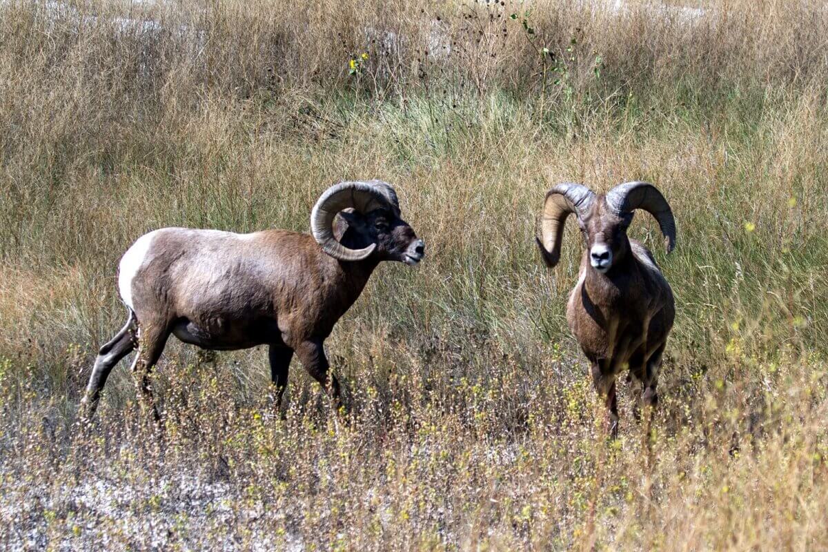
Dr. Justin White’s research interests include geospatial data science, aerial image analysis, artificial intelligence, environmental modeling, and biogeography. He is currently conducting research regarding greening in the western United States related to increased CO2, and developing an environmental harshness index. Dr. White is conducting biogeographical research with various collaborators, focused on bighorn sheep, eagles, hawks, mice, beavers, and desert plants.
Dr. Steve Radil, a political geographer, researches and examines the geographical dimensions of armed conflicts, including terrorism, interstate war, civil war, and urban violence. He has regional expertise in sub-Saharan Africa and East Asia and has published on a diverse set of political issues. Dr. Radil has methodological expertise in spatial analysis, social network analysis, and Geographic Information Science and routinely uses these tools in his work.
-
Can I validate any courses or apply transfer credits?
For information on academic experience that qualify for validation or transfer credits, please speak with your Advisor-In-Charge. You may also contact Lt. Col. Justin Cook at (719) 333-3080 or at justin.cook@afacademy.af.edu.